Asset tagging for trees
In Canada, organized efforts to manage municipal assets are increasingly the rule rather than the exception. The town of Whitby is a good example of the trend. The municipality recently completed a two-year program to tag every one of the 40,000 trees that line its boulevards and public spaces as a first step in the development of a long-term management plan for what it calls its “urban forest.”
With a population of about 130,000, Whitby is located in the greater Toronto area. Its natural harbor on Lake Ontario has helped it earn the title of the business center of the surrounding Durham Region.
Greg Hardy, P. Eng., the manager of Whitby’s Engineering and Infrastructure Services, explains that public infrastructure asset tagging movement has been spreading through Canada since 2008. In that year, provincial governments across the nation approved an initiative spearheaded by the Institute of Chartered Accountants requiring all municipal governments to list their tangible capital assets in their official financial statements. Then, in 2012, the Ontario Ministry of Infrastructure launched another initiative, this one called Building Together, which offers guidelines for the development of municipal Asset Management Plans.
But Whitby has been among the first to embrace the science of public asset management, says Hardy. “It is my opinion that the town of Whitby, via my predecessors, were in the forefront of [Ontario’s] medium-sized municipalities… in having the mindset of understanding the total lifecycle costs of owning and managing public assets as a common practice in decision-making processes,” he says. “This is obviously a key component of a comprehensive asset management program.”
The Whitby effort is led by the Asset Management Section of the Engineering and Infrastructure Services Department of the Public Works Department. It has two full-time staffers and several summer interns.
It was the interns who completed the mammoth task of asset tagging every tree in Whitby’s urban forest. As Hardy explains it, “Two summer students were used for the tree inventory project for eight months split over two years.” They were equipped with GPS-enabled computers, digital cameras, tapes, laser range finders and other necessary tools and supplies to collect a select number of tree attributes. They recorded each tree’s location, offset, species, height, canopy size, diameter, estimated age, condition, life expectancy, replacement value, presence of overhead utilities, cause of sidewalk heaving and other factors.
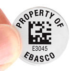
The project was undertaken with great care for the welfare of the trees, which were tagged with two-inch aluminum bar code tags with unique ID numbers. The tags were attached with one-inch aluminum nails. “The head of the nails are left approximately half an inch away from the bark to allow the tree to grow,” said Hardy. And, he noted, the asset-savvy project made sure to use aluminum nails so as not to damage saws during future maintenance.
The Asset Management team recorded each tree’s measurements and condition, and assessed the overall health and structural integrity of each. They collected the data with high-accuracy GPS-enabled tablet computers and transferred it into a corporate GIS database.
The goal, says Hardy, is to create a Tree Management Plan, which will help the town establish a methodology for the development of a healthy and sustainable urban forest and to deal with the challenges that this forest will inevitably face, such as pests and pathogens, climate change, invasive species, problems related to space to grow, damage to sidewalks from tree roots and soil salinity due to road salt use.
The assessment of the trees will be ongoing; Hardy explains that, “Town staff will soon be utilizing handheld units with built-in GPS, cameras and bar code scanners to view and update information and data onsite. The information will be used to keep track of maintenance activities, receiving and closing work orders onsite to achieve… efficiency in providing services to our residents.” An arborist will also be involved in the ongoing assessments of Whitby’s trees.
This is a progressive model of modern urban landscape asset management — 40,000 trees, taken one tree at a time. It’s a model that any municipality, anywhere, can learn from.
Category: Barcodes and RFID


